 |
Snap4Mobility and Transport
|
|
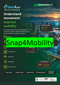
Snap4Mobility & Transport AI-enabled Digital Twin and SnapAdvisor Copilot for smarter mobility operations and plan, prediction and decision support PDF: https://www.snap4city.org/download/video/snap4mobility-2026-v04.pdf |
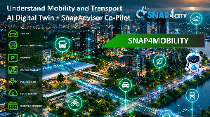
Snap4Mobility & Transport
AI-enabled Digital Twin and SnapAdvisor Copilot for smarter mobility operations and plan, prediction and decision support
|
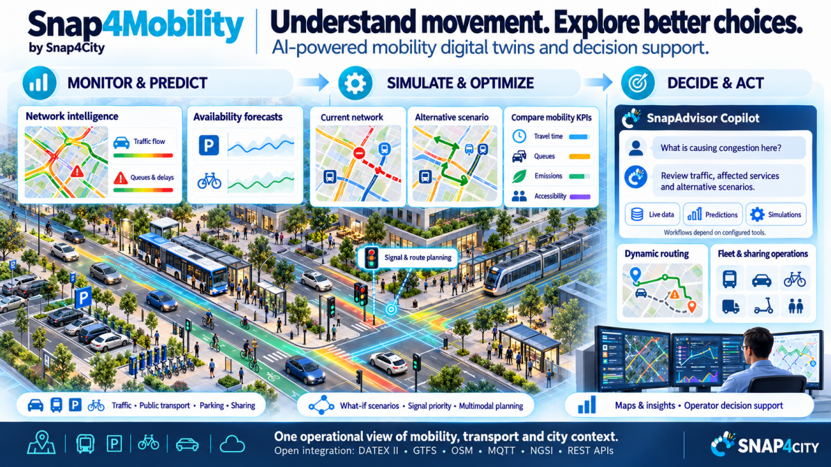
From city data to coordinated action Snap4City brings together real-time and historical mobility data, predictive analytics, simulation, optimisation, routing and operational tools in one Smart City Digital Twin. SnapAdvisor Copilot adds a conversational and agentic AI layer that can understand objectives, plan multi-step analyses, invoke configured Snap4City services and explain actionable outcomes in natural language. |
SEE Unified real-time view of traffic, public transport, parking, shared mobility, people flows, events, weather and environmental conditions. |
PREDICT Forecast congestion, parking availability, public-transport delays, demand, pedestrian peaks, emissions and other KPIs. |
PLAN & SIMULATE Run scenarios and what-if analyses for road changes, traffic-light plans, routing policies and transport-service alternatives. |
OPTIMISE for PLANNING Use decision-support and AI/DRL approaches to improve traffic signals, infrastructure and public-transport offer against measurable objectives. |
ACT Support dynamic routing, control-room interventions, digital signage, permissions, fleet operations and authorised workflows through APIs. |
ASK Use SnapAdvisor Copilot as a natural-language interface to data, analytics, routing, simulation, optimisation, RAG knowledge and visualisation. |
Safer • More accessible • More efficient • Multimodal • Lower-emission mobility
One Digital Twin for the complete mobility management cycle
Snap4City integrates heterogeneous mobility and urban information within a common environment for city operators, transport authorities, planners and citizens. The platform supports the full cycle from monitoring and early warning to prediction, simulation, optimisation and long-term planning.
Traffic intelligence Traffic monitoring, flow reconstruction, critical-condition detection and short-term prediction from distributed sensor networks and other mobility sources. |
Public transport Schedules, stops, routes, vehicle positions and arrival information across buses, trains, trams and ferries; demand-versus-offer analysis and service optimisation. |
Parking: on-road and off-road On-street and off-street parking, occupancy prediction, smart curb management, loading zones, disabled parking, payments and permissions. |
Routing & MaaS Modal and multimodal routing for drivers, cyclists, pedestrians and public transport, including current traffic, closures, restrictions and specialised public-service routing. |
Fleet & shared mobility Fleet management, sharing, pooling, e-sharing, connected vehicles, charging infrastructure and Mobility-as-a-Service scenarios. |
Apps & control rooms Smart City Control Rooms, dashboards, mobile/web apps, digital signage and APIs for operators, fleet drivers and city users. |
Permissions and subscriptions Permissions for parking for disable, residents, delivering, industries, access to RTZ, waste delivering, etc. |
Enforcement and fines Back office and mobile app for On-Road Operators, Fine management systems, fine emissions on road and from back office. |
User Engagement Collecting user complains regarding services, integration with ERPs, automated management of complains. |
Open to Multiservices Multi-services: environment, weather, POI, personal data, etc. |
TARGET OUTCOMES |
|
Planning Goals Reduce congestion, travel time, waiting time, fuel use and operational costs.
Improve accessibility to services, public-transport reliability and city-user safety.
Coordinate incident, roadwork, event and restricted-area management.
Improve the utilisation of parking, curb space, fleets and charging infrastructure. |
Sustainable Goals
Reduce CO2, NOx and other mobility-related emissions.
Support sustainable mobility indicators such as SUMI/PUMS and other city KPIs.
Assess accessibility and 15-minute-city style indicators.
Evaluate long-term infrastructure and service changes before implementation. |
|
Data and interoperability by design The mobility vertical is sensor-agnostic and can integrate traffic sensors, ODM/mobile-operator data, GIS/BIM, parking, tickets, public transport, cameras, sharing services, weather, air quality and more. Integration options include LoRaWAN, NB-IoT, MQTT, NGSI, HTTPS, AMQP, REST APIs, Mobility Data Space and standards such as DATEX II, OSM and GTFS, any other format and protocol. |
Real-time control, prediction and coordinated response
A unified mobility control centre can combine operational conditions across roads, public transport, parking, shared mobility, pedestrians, events, weather and environment. Snap4City can identify critical situations early, estimate what happens next and support the choice of response.
MONITOR & DETECT
Traffic status, reconstruction, queues, roadworks and blocked roads.
Public-transport offer/status, vehicle positions and delays.
Parking and curb occupancy, loading zones and EV charging.
Micromobility and sharing availability; fleet location and status.
Pedestrian people flow, restricted-zone access and city-user behaviour.
Weather, environmental conditions, events and incident context. |
PREDICT & ANTICIPATE
Congestion 15-60 minutes ahead and expected queue lengths.
Public-transport delays and potential impacts on lines.
Parking-area status and occupancy percentage.
Pedestrian peaks and accident-risk indicators.
CO2/NO2 emissions and other sensor/KPI forecasts.
Any configured time-series or KPI variable using supported forecasting methods. |
DECISION SUPPORT: FROM PREDICTION TO INTERVENTION |
||
Traffic Signals Optimization Recommend or optimise traffic-light plans, dynamic green waves and priority strategies for buses, trams and emergency vehicles, rapid transit busses. AI and DRL |
Traffic Infrastructure Optimization Recommend or optimize traffic infrastructure viability, reduce travel time, congestion, consumption, emissions, via AI and DRL |
Public Transport Optimization Assess demand versus service offer and support route, schedule or dispatching adjustments. AI and DRL |
Information actions Support Variable Message Signs, digital signage, mobile information and user-engagement/incentive actions. |
Scenario comparison Compare alternatives and estimate effects on congestion, queue length, waiting time, reliability, emissions and accessibility. |
Safety & resilience Analyse dangerous intersections, pedestrian/cyclist risks, incidents and demand peaks around events. |
Dynamic routing Re-route according to current/typical traffic, obstacles, restrictions and service-specific constraints. |
Example operator question “What is causing the congestion in this area, which routes and bus lines will be affected in the next 30 minutes, and which intervention is expected to reduce queues and emissions most?” |
|
A conversational and agentic AI layer for the Mobility Digital Twin
SnapAdvisor Copilot extends the Snap4City decision-support system with a multilingual conversational/RAG assistant and Agentic AI capabilities. Users can describe an objective in natural language instead of manually navigating APIs, data models, GIS tools or analytical workflows.
1 UNDERSTAND Interpret the operator objective in natural language. |
2 PLAN Build a multi-step workflow and select specialist agents/tools. |
3 EXECUTE Invoke Snap4City services and APIs; collect and analyse results. |
4 VERIFY Review outputs, recover from failures and re-plan when needed. |
5 EXPLAIN Return an actionable answer with text, maps, charts or dashboard content. |
One conversational interface. Multiple mobility capabilities.
Geo intelligence Geocoding, spatial search, areas/polygons, distance calculations, POIs and location-aware analysis. |
IoT & urban data Discover devices/entities, access metadata and retrieve live or historical observations by location/category. |
Mobility & routing Public transport, agencies/lines, stops/schedules, modal, multimodal, constrained and dynamic routing. |
Analytics & prediction Time-series statistics, correlations, PCA/regression/Granger analysis, error metrics, univariate and multivariate forecasting. |
Traffic intelligence Traffic Flow Reconstruction, critical-road-segment identification, traffic trends and mobility analysis. |
Simulation & what-if Scenario creation/modification, SUMO/MODOM simulations and questions of the form “what happens to X if Y occurs?” |
Optimization Traffic light signals and sync., traffic infrastructure, public transport offers with respect to demand, via AI DRL. |
Knowledge/RAG Combine live Digital Twin data with private documents, reports, regulations and specialised expert knowledge collections. |
Notification and Alerting Automated identification of critical conditions and alerting notifications, and rationales. |
Decision support KPI computation, scenario comparison, system-thinking strategies, optimisation and DRL-based approaches. |
Visualization & Business intelligence Generate maps and charts, and populate Snap4City dashboards with routes, POIs, IoT devices, heatmaps, traffic flows and tables. |
Reporting Generate reports with text, maps, tables, rationales, justifications and suggestions, AI explainability. |
|
Built for configured, multi-step decision-support workflows A city operator can ask the Copilot to collect evidence from the Digital Twin, analyse trends, calculate routes or KPIs, compare locations or periods, invoke configured prediction/simulation and optimization of services, and explain proposed solutions. Full end-to-end workflows depend on the tools and services configured for the deployment; the supplied Copilot roadmap explicitly distinguishes broader workflow synthesis from experimentally validated scope. |
Natural-language questions that connect data, analytics and action
Understand now “What is happening in this area?” “Why are there no free parking slots here?” “What caused congestion to reach 90% on this road?” |
Route intelligently “Which route is better considering current conditions?” “Find the sensors and POIs along this route.” |
Anticipate “Analyse these traffic trends and predict what happens next.” “Which bus lines are most exposed if queues grow over the next 30 minutes?” |
Test scenarios “What happens if traffic increases by 20%?” “Compare two signal plans and show the impact on queues, travel time and emissions.” |
Optimise “What can be done to reduce CO2 emissions on this corridor at 09:00?” “Which intervention best improves accessibility while reducing congestion?” |
Communicate “Prepare a concise operator report with a map, time-series charts, critical segments, recommended actions and expected KPI impact.” |
EXPERIMENTAL EVIDENCE REPORTED FOR SNAPADVISOR COPILOT |
|
|||
90.5% Planner F1 |
92.9% Retrieval precision |
86.6% Domain-expert F1 |
81.8 Average G-Eval correctness |
|
Specialist-agent selection |
Against direct SPARQL ground truth |
Evaluation on 90 queries with 4-8 reasoning steps |
Agentic configuration |
|
These figures are taken from the supplied SnapAdvisor Copilot summary and refer to the evaluated implementation described there.
|
Why this changes the control-room experience The Copilot turns the Digital Twin from a collection of dashboards and APIs into an interactive decision-support environment: the operator states the objective, the system orchestrates the configured tools, and the result is returned in an explainable, operational form. |
Flexible, interoperable and deployable across cities and applications
Multi-tenant by design One horizontal platform can support multiple cities, tenants and vertical applications, with customised user interfaces and dashboards. |
Open integration Open APIs connect mobility data and services with ERP, billing, GIS, IoT platforms, municipal CRM, legacy systems and third-party services. |
Standards & protocols Support for common protocols and standards including LoRaWAN, NB-IoT, MQTT, NGSI, HTTPS, AMQP, REST APIs, DATEX II, OSM and GTFS, more than 190 protocols. |
Security & access Cybersecurity controls, role-based access, OAuth and directory/login integrations; GDPR-oriented deployment practices. |
Cloud or on-premise Deploy as a service or on premise, with gateways in the field or provided by third parties. |
Horizontal smart-city platform Mobility can coexist with other verticals such as parking, lighting, waste, environment, assets, GIS, tourism and buildings. |
SELECTED SNAP4MOBILITY SOLUTIONS |
|
Operational solutions
Snap4Parking: parking, permissions, fine management and user/operator apps. (see Smart Cyprus, Snap4Ispra, etc.)
eShare: fleet management, sharing and pooling.
Snap4Gate: gate management for ports and parking (see Port of Salerno).
Info Mobility: mobile apps, digital signage and service information.
Unified dashboards and Control Rooms for multimodal operations (see Snap4ISPRA). |
Planning and Decision-support solutions
Traffic flow reconstruction and predictions.
Traffic-light and traffic-infrastructure optimisation.
Demand-versus-offer assessment for public transport.
Mobility simulations and real-time what-if analysis.
SnapAdvisor Copilot for conversational, multi-tool decision support. |
References
-
Bari - Mobility4Future platform powered by Snap4Tech.
-
CN MOST - National Center in Italy on Sustainable Mobility. Snap4City for CN MOST
-
Applications in Florence and Prato areas, Italy.
Read more on former solution and modules
-
SOLUTION: SUMI Manager
-
SOLUTION: MODOM, Data-Driven Mobility Demand-Versus-Offer Matching by Dynamic Integration of Public and Sharing Services
-
HOW TO: define Device in mobility, Mobile IOT Devices, Sensor Mobile
-
Solution: Snap4City integration with Mobility Data Space, MDS
-
Data Analytic: Traffic Flow Reconstruction
-
Scenario: Mobility and Transport Analyses in multiple cities
-
Optimizing Mobility and Transport Infrastructures
-
SOLUTION: Traffic Infrastructure Optimisation: reducing travel time and emissions
-
How to: Save a Traffic Flow Reconstructed on Snap4City
-
Smart City Digital Twin by Snap4City, 2026 version
-
Snap4City Simulation Supports for Digital Twins
-
Dashboard info: Mobility and Environment What-IF Analysis, Florence
-
Snap4City Mobility and Transport, Operation and Plan Digital Twin
-
UrbanDT4TF: Urban Digital Twin for Traffic Flow
-
Snap4City for CN MOST
-
SASUAM: Solutions for Safe, Sustainable and Accessible Urban Mobility
-
SOLUTION: Integrated Solution for Vehicles and Containers Monitoring
-
Data Analytic: Origin Destination Matrices, Algorithms and tools
-
HOW TO: activate tridimensional view on Dashboards, 3D views on Dashboards
-
SOLUTION: Snap4City Digital Twin Simulation Support
-
OPTIFaaS: Operation and Plan, Transport Infrastructure and Facilities Support as a Service
-
How to: compute and save heatmaps, and to compute predictions with Python
-
How to: Exploit SUMO simulator on Snap4City Platform
-
Available Bikes and Free Slots Prediction On Bike Sharing Stations
-
Digital Twin: Snap4City 3D Building Editor Documentation
-
How to control you city and solution: KPI suggestions from Snap4City
-
How to: Routing with What-if, find a route among points and to-be-avoided areas
-
SnapAdvisor: A LLM Expert at your disposal H24/7 on Snap4City and your private content.
- SOLUTION: Agentic AI for Natural-Language Access to Snap4City Data and Services
Contact: snap4city@disit.org Snap4Mobility & Transport | SnapAdvisor Copilot | Powered by Snap4Tech |
