 |
|
 |
|
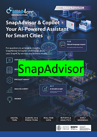
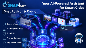
SnapAdvisor & Copilot is the evolution of the Snap4City digital twin decision support system with conversational/RAG assistant and AI Agentic capabilities. Instead of only answering questions from documentation and private knowledge collections, the SnapAdvisor & Copilot can interpret a user's objective, construct a multi-step plan, select and invoke Snap4City services and APIs, analyse the returned data, recover from execution failures, eventually replan, correlate results from different domains, and finally explain the outcome in natural language. SnapAdvisor & Copilot brings a new generation of conversational intelligence to the Snap4City Digital Twin. Users no longer need to understand APIs, data models, IoT platforms, GIS tools or complex analytical workflows. Simply describe the objective in natural language. Moreover, the SnapAdvisor & Copilot provides information about what the user can do to solve problems and develop solutions by using and suggesting Snap4City tools. Therefore, SnapAdvisor & Copilot is suitable for decision makers, for city operators and for the smart application developers. pdf: https://www.snap4city.org/download/video/snapadvisor-2026-v06.pdf |
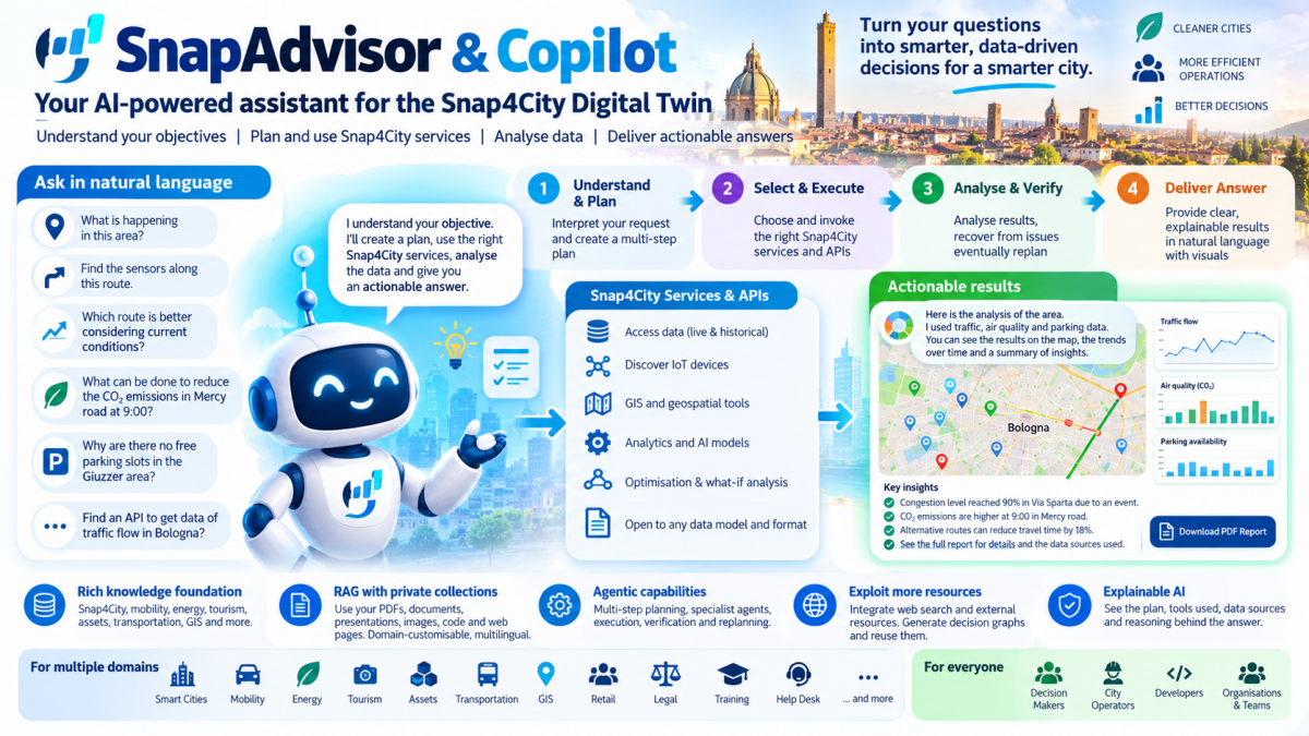
SnapAdvisor & Copilot understands the requests, creates a plan, selects the right Snap4City services, executes the required operations and delivers an actionable answer. SnapAdvisor & Copilot provides answer to your requests as "What is happening in this area?", "Find the sensors/POI along this route.", "Which route is better considering current conditions?", "Analyse these trends and predict what happens next.", "What happens in this scenario if traffic increases of 20%?", “Why there are no free parking slots in the Giuzzer area?”, “What caused a congestion level of 90% in rue the Sparta?”, “What can be done to reduce the CO2 emissions in Mercy road at 9:00?”, “which tool I should use to create an entity?”, ”Find some API to get data of traffic flow in Bologna?”, etc.
SnapAdvisor & Copilot provides a strong knowledge-oriented foundation about Snap4City, mobility, energy, tourism, assets, transportation, GIS, etc. It includes a multilingual, domain-customisable virtual assistant based on advanced Retrieval-Augmented Generation (RAG) LLM, capable of working with private collections containing PDFs, documents, presentations, images, code and web pages. Collections can be created, added and changed according to the user's domain, allowing different organisations or groups to add specialised expertise without retraining the underlying LLM. The SnapAdvisor & Copilot is a support tool for developers learning and exploiting Snap4City and as a configurable assistant for operators and decision makers working with application-specific information, in the multiple domains of smart city but also for retails, legal aspects, training, help desk, etc.
The workflow of actions can be summarised as: User request → (re)Planning → Specialist agents → specialist and Snap4City services → verifier and review (eventual replanning) → answer (in text and graphics). SnapAdvisor & Copilot “Understand what I want, determine how to provide, use the Digital Twin and its services to perform the required operations, and tell me the result.”
The experimentally validated implementation provides several specialist areas. The SnapAdvisor & Copilot provides useful evidence that this is more than a conceptual architecture. In its evaluation of the early 2025 version, the Planner achieved an overall F1 of 90.5% for specialist-agent selection. Against direct semantic search ground truth, retrieval obtained 92.9% precision. Domain-expert evaluation produced F1 = 86.6% on 90 queries, involving from 4-8 reasoning steps. Most importantly, the agentic configuration achieved an average G-Eval correctness of 81.8.
The 2026 SnapAdvisor & Copilot version is much more powerful in terms of knowledge, tools, and colloquial user interface, which provides evidence of the plan and replan performed, to produce reports in PDF regarding chat and colloquial story; show results on maps, time series and bar series, tables, images, etc.; providing evidence of the resources exploited to produce the answer (explainability of the AI reasoning); generate dynamic decision graphs and reuse them; search directly on WEB for additional resources. SnapAdvisor & Copilot performs autonomous operations according to your requests such as search on web, generate new decision graph, generate plan for solving problems, create optimizations, computing inferences by using AI models, generate predictions, prepare plan to periodically perform activities, etc.
SnapAdvisor & Copilot is being able to orchestrate a range of tools’ families for accessing, processing and generations of:
- Data Management: Snap4City High Level Types management, ingestion and rendering • Open to any data model and format, according to Snap4City capabilities • Discover IoT devices • Retrieve metadata • Access live and historical observations • Search entities by location and category • Automated production of data models and entities, time series generation/saving • connection to data spaces.
- Geospatial analysis and reasoning: Geocoding • Spatial search • Areas and polygons • Distance computation • POIs • Location-aware analysis • POI, IOT, entity information, enrichment • Utilities: geo location standards, date and time, conversions of formats.
- Mobility and transport: reasoning and simulation (SUMO, MODOM, TFR): Public Transport services show and analysis • mobility analysis • critical road segments identification • Mobility Routing, multimodal routing • Show and generation of Traffic flow reconstruction • Mobility and transport What-if and simulation, for traffic infrastructure, public transportation • Computing mobility and transport KPI (travel time, fuel consumption, emissions, SUMI) • Mobility and transport Optimization
- Knowledge and expertise provided and additional: Simple orientation information from collection of documents, slides, images • Exploitation of multiple expertise • Creating expertise as extracting data from: text, doc, pdf, slide, web pages, images • Web Search to get new expertise • Specialized events and API search from web • exploiting and extending Snap4City Ontology / Km4City. Ready to use expertise on: Snap4City, Mobility and Transport, Parking management, Waste management, Smart Light, Tourism Management, etc.
- ML/AI reasoning, inference and computing: predictions, statistics analysis, heatmaps, origin destination matrices • Open to any ML/AI tools via MLOps of Snap4City • performing new training on demand • Time-series analysis • Min/Max/Average • Correlation • PCA • Regression • Granger causality • Error metrics • computing typical time trends, daily and weekly • time series interpolation • time series resampling.
- Media processing: Interpreting images (image to text) • generating images from descriptions • modification of images according to description.
- Rendering on web pages and PDF files for reporting: Generation of reports from results • Formatting data: tables, lists, plans, documents, images, itemizes, sections • Including maps, time series and barseries • Dashboard rendering on maps (IoT, POI, routing, heatmaps, traffic flow, scenarios, etc.), multiple time series, barseries, etc. • generation of reports from chats • automated generation of reports.
- High level reasoning, extending reasoning capabilities, production of new decision models and graphs: Automated creation of new strategies and decision graphs according to systems thinking by accessing to local and/or external knowledge and expertise • probability charts • reporting
SnapAdvisor & Copilot is GDPR compliant, and it is capable to work on: personal information and data accesses, single or multiple organization / tenant respecting separation of concerns and data, multiple users, multiple languages, etc.
The tool catalogue is particularly important because it points towards an agent able to complete an entire decision-support workflow, not merely retrieve data. For example, a city operator could potentially ask: “Analyse the expected impact of tomorrow's major event on mobility around the city centre, identify critical road segments, estimate traffic conditions, compare alternative scenarios, suggest mitigation measures and prepare a report with maps and graphs.” SnapAdvisor & Copilot decomposes such an objective into event retrieval, geographical definition, historical-data extraction, predictive analytics, traffic modelling, simulation/what-if analysis, KPI computation, optimisation, visualisation and report generation. This example is a synthesis of the capabilities in the supplied roadmap rather than a claim that this complete workflow has already been experimentally validated.
SnapAdvisor & Copilot provides for city operators, a conversational interface for the control room: retrieving conditions, comparing locations or periods, identifying anomalies, calculating routes or KPIs, and potentially running simulations and what-if analyses. For decision makers, it suggests a transition from information retrieval toward a conversational Decision Support System, where the agent can collect evidence, compute indicators, compare alternatives and explain proposed solutions. For developers, it is an expert on multidomain documentation (topics: Snap4City, mobility and Transport, Energy saving, Tourism management, parking management, waste management etc.) while potentially becoming a co-pilot can locate APIs and services, construct workflows and exploit the platform's available microservices. SnapAdvisor provides information about the costrs in terms of tokens and computational time consumed.
Snap4City development environment allows you to customize and develop your Powered By Snap4Tech SnapAdvisor & Copilot by (i) defining and feeding a number of knowledge collections with any kind of document and web pages, (ii) adding specific tools via API and MCP standard, (iii) creating the visual graphic visual interface of the solution exploiting the Snap4City dashboard builder, and CSBL facilitates.
These are the most relevant Snap4City.org pages, ordered by relevance. Start with 1 and 2 for SnapAdvisor’s agentic capabilities and tools.
| # | Web page | Why it is relevant |
|---|---|---|
| 1- | SnapAdvisor & Copilot: Agentic AI smart city co-pilot for decision makers and/or developers | Main overview of planning, tool orchestration, analytics, maps, reports and decision graphs. Snap4City |
| 2- | SOLUTION: Agentic AI for Natural-Language Access to Snap4City Data and Services | Most relevant technical page: seven specialist agent categories and approximately 65 MCP tools, including geolocation, service discovery, IoT, data retrieval, mobility and routing. Also explains supervision and replanning. Snap4City |
| 3- | SnapAdvisor: A LLM Expert at your disposal H24/7 on Snap4City and your private content | Explains the multilingual RAG assistant, private knowledge collections, document inputs and domain customisation. Snap4City |
| 4- | SOLUTION: Reliable Way to Use LLMs With Domain Documents | Related CA-RAG research explaining how generated answers can be validated against source documents. Snap4City |
| 5- | Snap4Mobility & Transport | SnapAdvisor Copilot applied to mobility operations, routing, prediction and decision support. Snap4City |
| 6- | Snap4Tourism: Smart Tourism, smart retail, agentic AI, Digital Twin | Describes proposed agentic workflows combining visitor flows, events, mobility, predictions and scenario evaluation. Snap4City |
| 7- | Snap4Assets: AI-Powered GIS, Digital Twin and Intelligent Asset Management | Covers SnapAdvisor for technical documentation and the extension toward agentic asset investigations. Snap4City |
| 8- | Chronological evolution of Snap4City: from Km4City to Agentic AI | Explains the transition from knowledge-based SnapAdvisor to multi-agent orchestration and MCP tools. Snap4City |
Direct application access: snapadvisor.snap4city.org, as linked by the portal. Snap4City
Many instances of the Snap4Advisor and Copilot can be direcly placed on the any your dashboard.
