|
Overview slides
|
||
|
DOWNLOAD Snap4City Booklet 2026/2027
|
DOWNLOAD Snap4City flyer 2026/2027
|
|

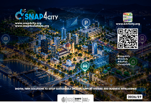
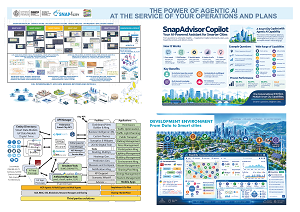
Connect city data. Explore scenarios. Make informed decisions. Discover Snap4City’s digital twin platform, bringing together agentic AI, real-time monitoring, simulations and business intelligence.
This overview explores how city teams, enterprises, developers and system integrators can connect information across services to support daily operations and long-term planning.
Explore capabilities including:
• 2D and 3D digital twins combining GIS, BIM, IoT sensors and historical data
• KPI monitoring, predictions, anomaly detection and early warnings
• What-if simulations and optimization to compare possible interventions
• SnapAdvisor Copilot for conversational analysis, planning and reporting
• Interactive dashboards, control rooms and mobile applications
• Visual development with Node-RED, custom Python and R analytics, and MLOps
• Open APIs, interoperability and integration with existing systems
• Cloud, SaaS and on-premise deployment with role-based access
Discover connected solutions across the Snap4City ecosystem:
• Snap4Assets — asset and infrastructure management
• Snap4Mobility — traffic and transport planning
• Snap4Parking — parking, payments and enforcement
• Snap4Tourism — visitor flows and destination management
• Snap4Light — smart lighting and energy monitoring
• Snap4Waste — collection planning and route optimization
• Snap4Environment — environmental monitoring and forecasting
See how SnapAdvisor brings natural-language questions together with configured data and analytical tools to help operators investigate conditions, compare options and review proposed actions.
Which city service would you connect to a digital twin first? Share your ideas in the comments, and subscribe for more Snap4City demonstrations and tutorials.
#Snap4City #DigitalTwin #AgenticAI #SmartCities #DecisionSupport
