see also Scenario: Control Room vs Video Wall
For a more complete overview please read:
- Development Life Cycle: https://www.snap4city.org/download/video/Snap4Tech-Development-Life-Cycle.pdf
- TECHNICAL OVERVIEW: https://www.snap4city.org/download/video/Snap4City-PlatformOverview.pdf
The City Officials need to get an overview of the city in glance on the basis of relevant aspects to make corresponding decisions if needed. DISIT Lab, in the context of REPLICATE project of the European Commission has set up a Smart City Control Room by collecting a relevant amount of data and performing the data analytics to provide a set of Dashboards for the control room. The whole set of Dashboards start from a main panel that is H24/7 accessible for the city major, where each tile/widget is autonomously updated and interactive to bring the user to a set of more detailed views on data and maps.


Video with Live demonstration 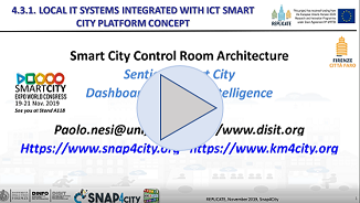
see on You Tube:
A set of connected views and tools
The observed views on the Control Room Dashboards are related to:
• Mobility and Transport: public and private transportation
• Key performance indicators of several gov services
• Civil protection alerts and conditions
• Major parking status and their predictions
• Major Public transportation mean delay at the bus stops
• Energy and consumption aspects for: e-Vehicle recharge, meters, ..
• Environmental aspects: pollution, pollination, waste, irrigator, ..
• Social aspects: social media, tags, citations, people flow,..
• Resilience of the city: civil protection, hospital first aid, evacuation paths, ..
• Analysis to perform a deep view into the city status from traffic to pollution up to the What-IF analysis
Predictions and Anomaly Detections
Most of the SCCR Dashboards for Firenze are private and not accessible to general public since they contain sensitive data. Others are public, for example that providing parking predictions with high precision, over the 97%, computed by using machine learning. This information of smart parking is also provided via Mobile App Km4City and permits at to users to avoid critical situations informing them in advance when the parking is not presenting free slots. In the set of Dashboards and tools, the data collected are related to point of interest, traffic flow, smart benches, irrigators, KPI on energy, KPI on administrative aspects, environmental sensor, weather sensors, public transportation plans data via GTFS and delays at the bus stops, parking status, triage status, social media trends on twitter, civil protection, Wi-Fi status, events of traffic from police department, etc.
https://www.snap4city.org/dashboardSmartCity/view/index.php?iddasboard=MTE3MA==
https://www.snap4city.org/dashboardSmartCity/view/index.php?iddasboard=MTE3Mw==
https://www.snap4city.org/dashboardSmartCity/view/index.php?iddasboard=MTE3NA==
Data Analytics What-If Analysis
The Florence municipality, with REPLICATE project of EC, started initially by exploiting Km4City (https://www.km4city.org) for data aggregation. Then the production of dashboards has strongly improved the solution. Recently, Florence passed to Snap4City more powerful platform which has integrated the former solution. Snap4City provides a range of solutions and a secure environment for Smart City Control Room. Relevant aspects are also related to the Data Analytic and Analysis Tool by which the City Operators can perform What-If analysis dynamic routing on the basis of eventual unexpected events and taking into account: city context, pollution, traffic flow, cycling paths, etc. (see next figure in which a scenario has been drawn in the city marking the zone in which the traffic is going to be closed, and the new root has been estimated for different kind of travel means. All the new routing is estimated in real time when the use move the pins (start, stop, or intermediate).

https://www.snap4city.org/dashboardSmartCity/view/index.php?iddasboard=MjE5MA==
The above Dashboard exploits data analytics as: parking prediction, public transportation delay analysis, traffic flow reconstruction, prediction of environmental data.
Where you can test
The above features can be tested mobile Apps on Google Play or Apple Store, and on Dashboards accessible from Https://www.snap4city.org in the public set. On the dashboards, you can navigate on several predictions, in past and future and you can see the 24H animation of the next and past days.
Contact: Https://www.snap4city.org
Partners: Comune di Firenze, Città Metropolitana di Firenze
Download this technical note as PDF: https://www.snap4city.org/download/video/tn/Firenze-Smart-City-Control-Room.pdf
Other examples and connected scenarios:
- Dashboards Touch Screen Support for Situation Rooms and What-iF analysis Operators https://www.snap4city.org/drupal/node/511
- Smart City Control Room Dashboards: Big Data Infrastructure, from data to decision support https://www.snap4city.org/drupal/node/525
- Dashboard Info: What If analysis dashboard online help: https://www.snap4city.org/drupal/node/521
- Sindaco Nardella at Smart City Expo World Conference 2018 (ITA) https://www.snap4city.org/drupal/node/353
- Snap4City Dashboards: Overlook Your City https://www.snap4city.org/drupal/node/400
- Data Analytics: the cases of Antwerp and Helsinki, and general views https://www.snap4city.org/drupal/node/524
- TC1.20: Add a private chat room at your dashboard (public or private) https://www.snap4city.org/drupal/node/515
- Advanced Smart City API for mobile app development, development tutorial: https://www.snap4city.org/drupal/node/20
- Balancing of traffic in Florence, ingoing and outgoing flows: https://www.snap4city.org/dashboardSmartCity/view/index.php?iddasboard=MTc2MQ==
- Dashboard Life in Toscana with Origin Destination matrices, computed by Mobile App data: https://www.snap4city.org/dashboardSmartCity/view/index.php?iddasboard=MTc3NA==
- Dashboard Life in Toscana with Origin Destination matrices: https://www.snap4city.org/dashboardSmartCity/view/index.php?iddasboard=MTc3NA==
- Dashboard on Mobility on Florence: https://www.snap4city.org/dashboardSmartCity/view/index.php?iddasboard=OTA5
- Dashboard on mobility Pisa: https://www.snap4city.org/dashboardSmartCity/view/index.php?iddasboard=MjUy
- Mobile App on all Stores: https://www.snap4city.org/drupal/node/489
- Snap4City mobile App: City in a Snap (available for Antwerp and Helsinki): https://www.snap4city.org/drupal/node/448
- Trafair project: example of GRAL: https://www.snap4city.org/drupal/node/500
- Traffic Flow reconstructions: https://www.snap4city.org/dashboardSmartCity/view/index.php?iddasboard=MTc5NQ==
- P. Bellini, D. Cenni, M. Marazzini, N. Mitolo, P. Nesi, M. Paolucci, "Smart City Control Room Dashboards: Big Data Infrastructure, from data to decision support", Journal of Visual Languages and Computing,
https://ksiresearchorg.ipage.com/vlss/journal/VLSS2018/paper%2030.pdf - Dashboard info: Mobility and Environment What-IF Analysis, Florence
- Article on Sensors: https://www.mdpi.com/1424-8220/19/21/4798/htm , MicroServices Suite for Smart City Applications