Urban flooding is becoming an increasingly important challenge for cities, requiring tools that can not only predict where water will spread but also make complex simulation results understandable to planners and emergency managers. This work presents a flood-simulation framework that integrates the LISFLOOD-FP hydrodynamic model with the Snap4City Smart City Digital Twin platform. Simulation outputs are transformed into time-varying flood-depth heatmaps and visualized directly in an interactive 3D representation of the city.
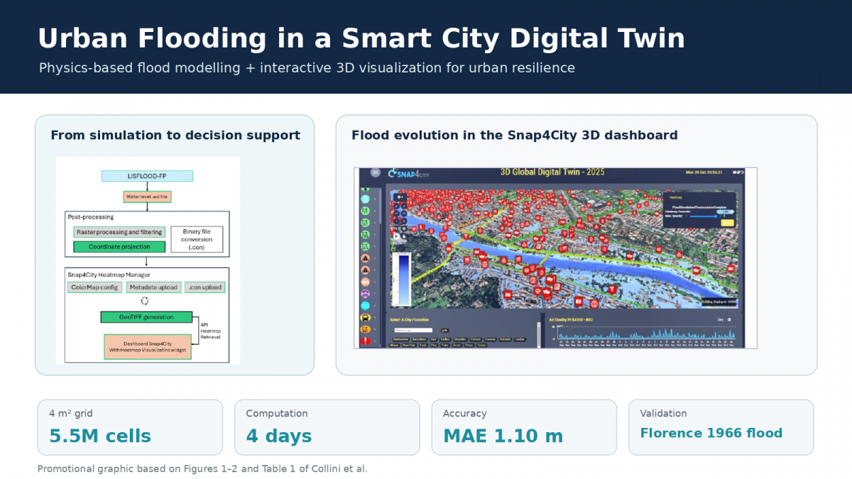
The resulting web-based environment allows users to explore how flooding evolves over space and time while viewing the results together with 3D buildings, infrastructure, points of interest, sensors, and other urban information. This makes the system a practical decision-support tool for identifying critical areas, understanding potential impacts, and planning emergency responses.
The approach was validated by reconstructing the historic 1966 Florence flood. A 4 m² simulation grid reduced the computational domain from 22.5 million to 5.5 million cells and computation time from approximately two weeks to four days, while maintaining comparable accuracy: MAE 1.10 m and RMSE 1.26 m.
Key message for promotion: the research connects physics-based flood modelling with an operational Smart City Digital Twin, turning complex hydrodynamic simulations into an intuitive 3D tool that can support more resilient urban planning and emergency management.
full version:
- E. Collini, M. Fanfani, F. Galli, P. Nesi, P. Zamperlin, "Assess Flooding Impacts in Urban Environment: Integrating Fluid-Dynamic Simulations in Smart City Digital Twin", proc. of the Int. Conf. on Computational Science and its Applications, University of Minhao, Braga, Portugal - June 30- July 3, 2026.
