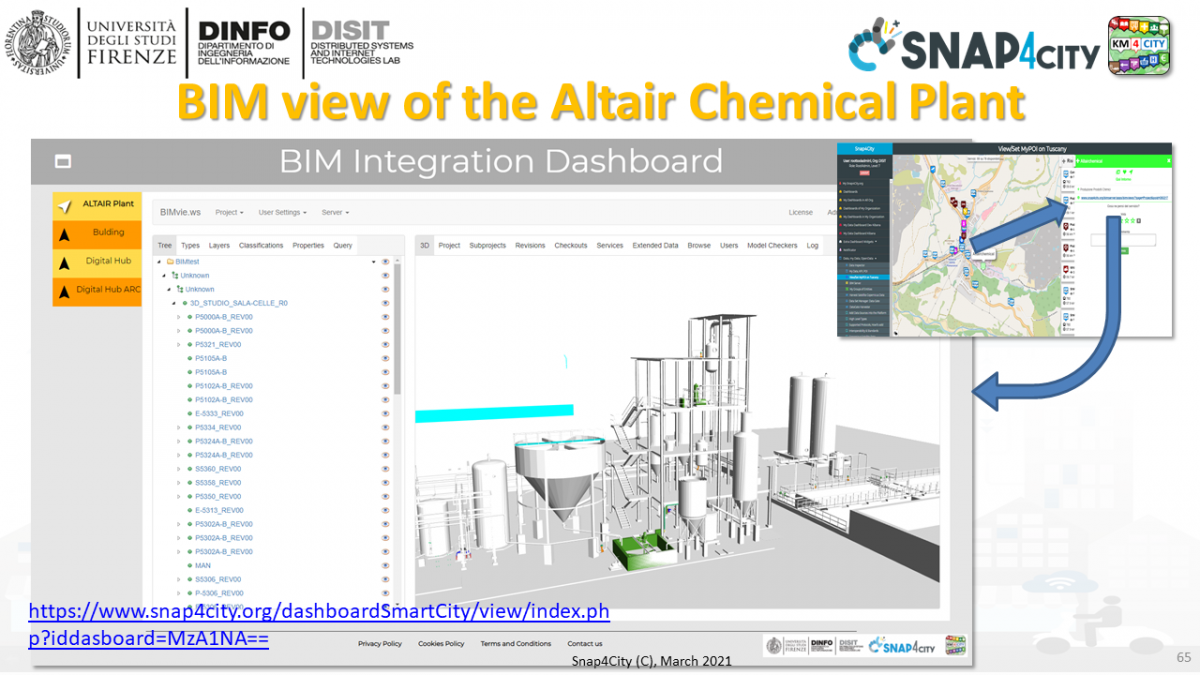
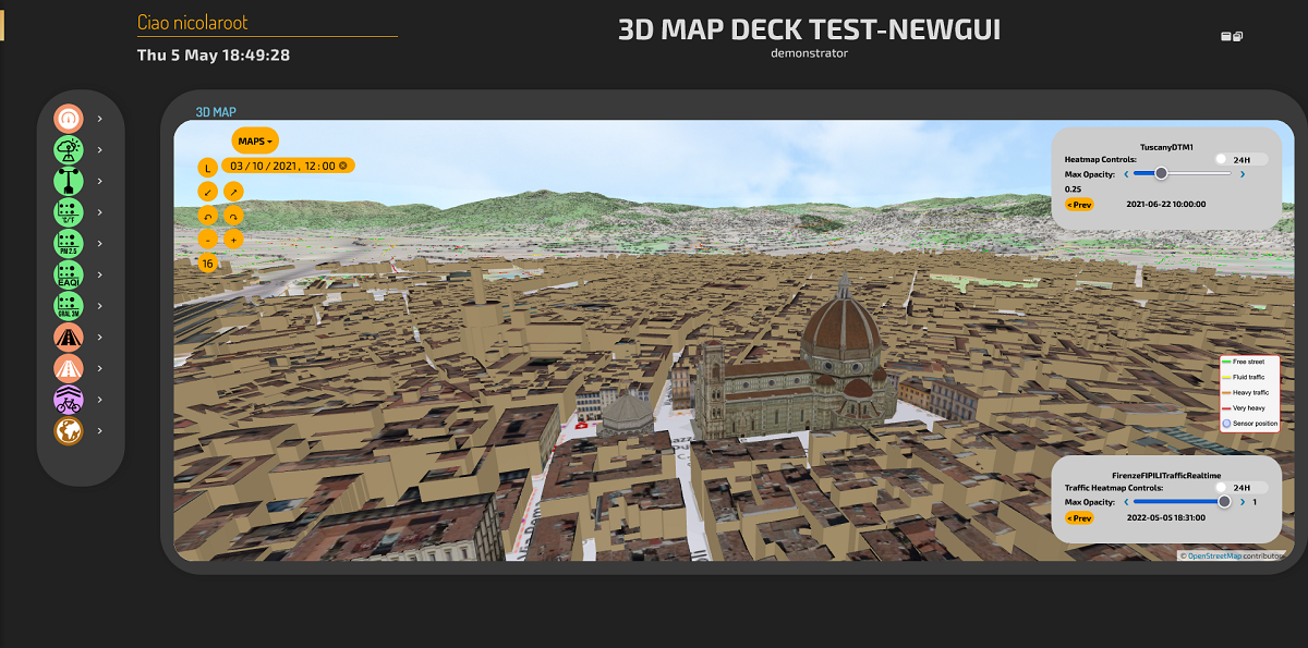
Please note that in Snap4City Global and Local Digital Twins (Gemello Digitale) are integrated with IOT models, maps, heatmaps, etc.
-
DOC: Global Digital Twin for Florence by Snap4City, 3D city view
-
https://www.snap4city.org/dashboardSmartCity/view/Baloon-Dark.php?iddasboard=MzQzMQ==
The so called Digital Twin approach implies to manage a digital counterpart of the real world. In the literature, we can identify the:
- Local Digital Twin: detailed aspects modeled in digital of a physical element, for example of a chemical plant with machine, motors, silos, etc., each of them with 3D representation, detailed components, real time values of sensors attached which can be used to understand its behavior in terms of real time data and funtionalities, mechanical parts to be disassembled for maintenance and inspection, etc. Several different levels of resolutions can be provided and the rendering is tyically performend on 3D modeling and view tools such as the BIM server. The 3D shape is obtained by starting from formats such as IFC, DXF, SVG (Scalable Vector Graphics), STEP, IGES, STL (STereoLithography), OBJ (Wavefront), DAE (Collada), SCAD (OpenSCAD), IV (Inventor). Some of them are open formats, other are proprietary and a large number of converters are present, even if several problems arise during conversions. The Local Digital Twin also may include the detailed description of floors, detailed description of data, devices, etc.

- you can place the pins into the 3D structures and views and directly see the historical and real time value of the devices and entities pinned. They can have multiple information describing the digital twin, time series, urls, and links to other entities, etc.
- you can jump from maps pin global to local 3D representations and viceversa.
- Digital Twin general view is representing the 3D shape of context: the city, the plant, the garden. In that case of the City, the representation can be very detailed as in the Local Digital Twin or simplied in shape and volumes. In the latter case, the modeling can be based on volumes formalized in GeoJson with geometry projections, with specific attributes as "height" and/or "roofShape", etc. See for example OSM maps with building https://osmbuildings.org/documentation/data/ The building shape may have a pattern smeared on them reporting the color and the look of the building, providing a more realistic view of the 3D simulated view. In most cases, it can be possible to pass from Digital Twin to the Local Digital Twin such as "entering in the detailed view".
In Snap4City both solutions are supported into the Dashboard Builder. The preferred format for Local Digital Twin is the IFC since it is an open format.
Examples are accessible from the Slides of the Course Https://www.snap4city.org/577
