This activity has been developed in the context of PC4City (Civil protectioon services for the City, protezione civile per la città) action founded by the Foundation Cassa di Risparmio di Firenze.
Rainfall induced landslides is one of the main geological hazards in the world. Each year it causes fatalities, casualties and economic and social losses in large populated areas. The solution developed provides accurate 1 day ahead prediction of landslides and this can be extremely important to local authorities that can set up an efficient early warning to increase the resilience on managing this type of emergency. Let’s see the details of this solution that:
- uses the data from a set of Internet of Things (IoT) sensors displaced in the area of interest;
- is Artificial Intelligence powered to achieve state of the art results in this field
- allows the realization of early warning 1 day in advance systems to monitor landslides events on the territory
In the Metropolitan City if Florence lives 1.5 M inhabitants in around 3,514 Km2. Considering the data used for this installation there is a mean number of landslides per year of about 57 that could be dangerous for the inhabitants of the area affected by these geological hazards.
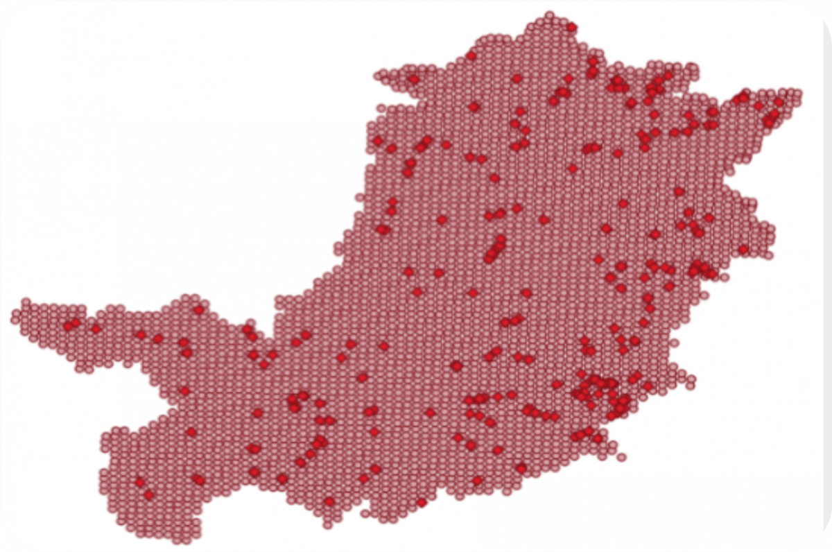
Grid and landslide events in the Florence Metro Area (Tuscany, Italy) from 2013 to 2019.
There is an extensive literature addressing the problem of landslides forecasting, and the most recent solutions are based on artificial intelligence (AI) machine learning and deep learning approaches. However, some state-of-the-art works are still empirical with limited precision.
For this high risk application the state of the art on landslide prediction for early warning has been carefully reviewed and not only the results of the AI developed achieves the best results in terms of evaluation metrics compared to the other related works but also related on data directly acquired on the territory.
| The AI solution developed is based on XGBOOST, and it has been demonstrated to outperform Random Forest, Convolutional Neural Networks, and solutions based on Autoencoders. It is capable to produce a prediction as the assessment of landslide proneness for each 1x1 Km square in the area one day in advance, every day and in each point of the territory. The obtained accuracy is of 99%, a specificity of 99%, and a sensitivity of 79%. Thus we obtained a TSS (true skill statistic) of 0.78 overcoming all the other methods at the state of the art and tested on the same data, which at their best reached the TSS=0.35. |  |
The solution proposed has another innovative pros by adding at the results / alarms an explanation by using Explainable AI techniques putting in evidence which factors are responsible for the landslide warning. This is a really important feature of the solution that allows the development of early warning systems reliable and usable by decision-makers enabling them to understand which are the particular measures acquired that are contributing to the prediction of the landslides of the next day. Trust our solution as your best experts that justify all suggestion provided.
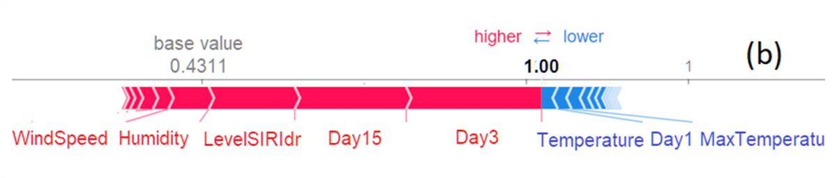
In the above image is a real case: the rain cumulated over the 3 days and 15 days previous the prediction time with the level of water in the substrate fired the early warning of the geological hazard event.
Partners: Snap4City, Fondazione Ente CR Firenze, Centro di Protezione Civile.
Please read and cite the work as: "Predicting and Understanding Landslide Events with Explainable AI." IEEE Access 10 (2022): 31175-31189
https://ieeexplore.ieee.org/stamp/stamp.jsp?arnumber=9732490