POI Loader is a wizard-based tool which aims at supporting users to ingest Points Of Interest (POI) data in an Excel file by establishing a direct connection between the file data and the Snap4City platform. Using POI Loader, it is possible to import (static) data, by uploading an Excel file and execute a set of operations to make the uploaded data compatible with the Snap4City platform and the KM4City multi-ontology. In other words, the data is uploaded as excel file in the tool, also asking to the providers to add some descriptors for each dataset (some of them connected to the KM4City classes), then is automatically aggregated to the other processed data in the platform in a semantic way.

POI Loader Overview
In the following sections, the general features and the process that are needed to be completed to ingest data, using POI Loader, is briefly described.
File Upload
The first step of data ingestion in POI Loader is uploading the Excel file.
Click here to download a template file.
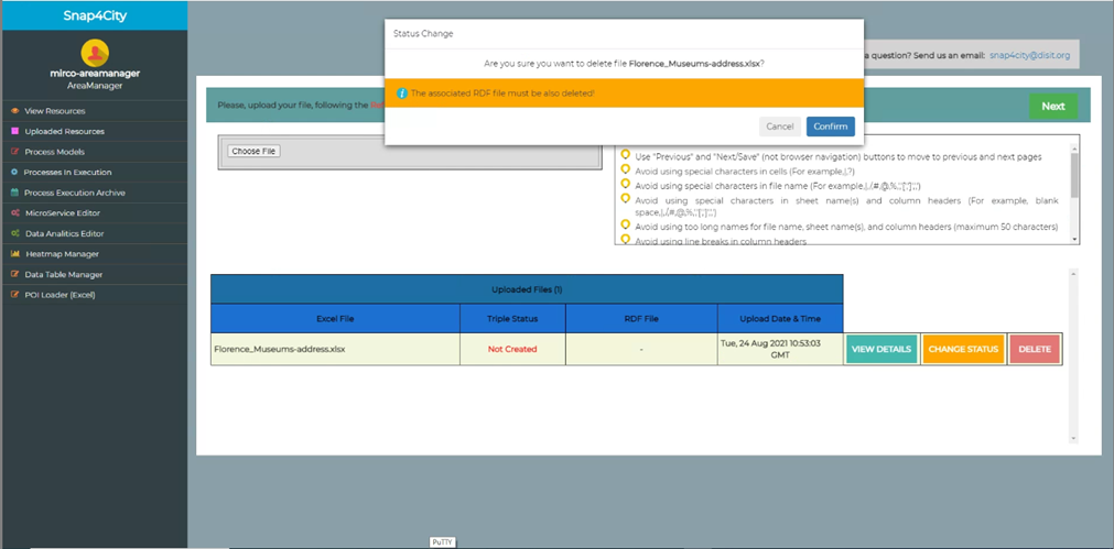
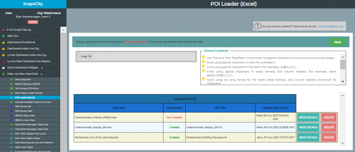
Some guidelines are provided to the user to assist him on how to upload an Excel file properly. If the user does not upload an Excel file, following the provided guidelines, s/he needs to edit the file and re-upload the file again. Also, a table which presents the information of uploaded files by the user is available and includes:
- the number of files that has been already uploaded by the user
- the maximum number of files to be uploaded by the user
- uploaded file (for each file in chronological order):
- File download (if the user role is "RootAdmin")
- Organization that is associated with the file (if the user role is "RootAdmin")
- filename
- upload date and time
- status: { RDF file: Created or Not Created}
- RDF file name (if Status=Created)
- possible actions for each file:
- View the file data and metadata, by clicking on “VIEW DETAILS” button, including:
- name
- abbreviation
- descriptionShort
- descriptionLong
- phone
- fax
- url
- refPerson
- secondPhone
- secondFax
- secondEmail
- secondCivicNumber
- secondStreetAddress
- notes
- timetable
- photo
- other1
- other2
- other3
- postalcode
- province
- city
- streetAddress
- civicNumber
- latitude
- longitude
Change triple status: to “created” if the associated RDF file has not been created
- Delete the file and the associated data created on Snap4City: (by clicking on “DELETE” button). This functionality is available only if the associated rdf file has not yet been created.
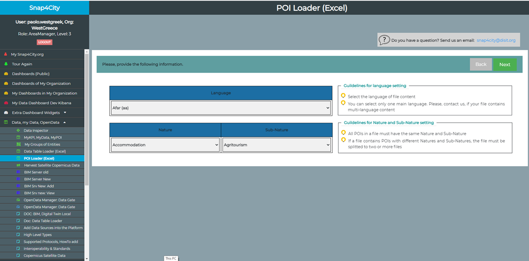
Inserting General Information
In this step, the following information is inserted/specified by the users:
- Language: of file content
- Nature & Sub-nature: of POI which describe a general and more detailed description for a POI
Each row has a latitude and a longitude
- Search Area: For each row (POI), if there is not a latitude and a longitude:
- values for provinces, City, streetAddress, and civicNumber columns are mandatory
- the user must specify a search area for POIs which includes:
- the latitude and longitude of the center of the search area
- the radius of the search area
A possible coordinate for each row then is returned by the tool which can be viewed in the next step.
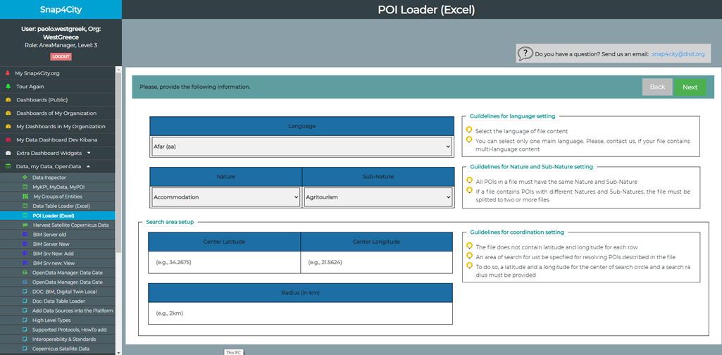
There is not a latitude and a longitude for each row
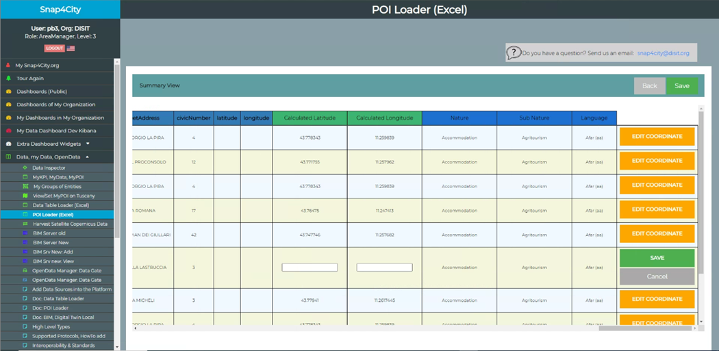
Preview
In this step, the user can see a preview of data inserted/specified and in the uploaded file. If there is no coordinate for each POI, in the preview table it is possible to manually edit the calculated coordinate using the provided search area in the previous step.
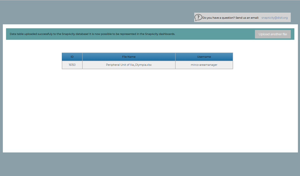
Uploaded File
In this step, the ID of uploaded file (in the ownership table), the file name, and the username which has uploaded the file is presented.
Uploaded File
File Status
Once a file has been uploaded, if the user goes back to the first page, can see the file name with the related status that can be: {Created, Not Created}.
- Created: the POIs have been uploaded in the Snap4City Knolwedge Base, are visible in the related map (Menu 'KnolwedgeBase and Maps --> ServiceMap') and can be used also to create dashbaords, etc.
- Not created: mean that the POI has not yet been entered in the KB.
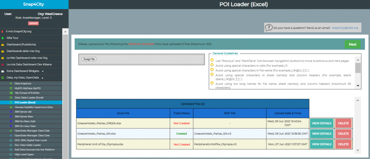
Example: The initial status of Peripheral Unit of Ilia_Olympia.xlsx file is ‘Not Created’.
The publication process is mediated: there is a responsible who will check the data, enter them into the KB and change the status of the dataset form 'Not Created' to 'Created'. So that each file/dataset will therefore have an initial status 'Not Created', when the publication is successful the mediator will update the status to 'Created'. The owner of the dataset will be able to see the updated status on the tool and view the data on a map, dashboards, etc.
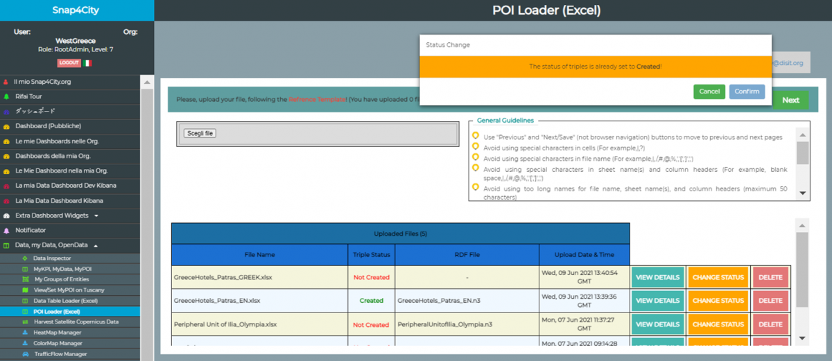
Example: The Mediator changes the status of Peripheral Unit of Ilia_Olympia.xlsx file to ‘Created’
Example: The data owner can see the new status ‘Created’ for the dataset Peripheral Unit of Ilia_Olympia.xlsx
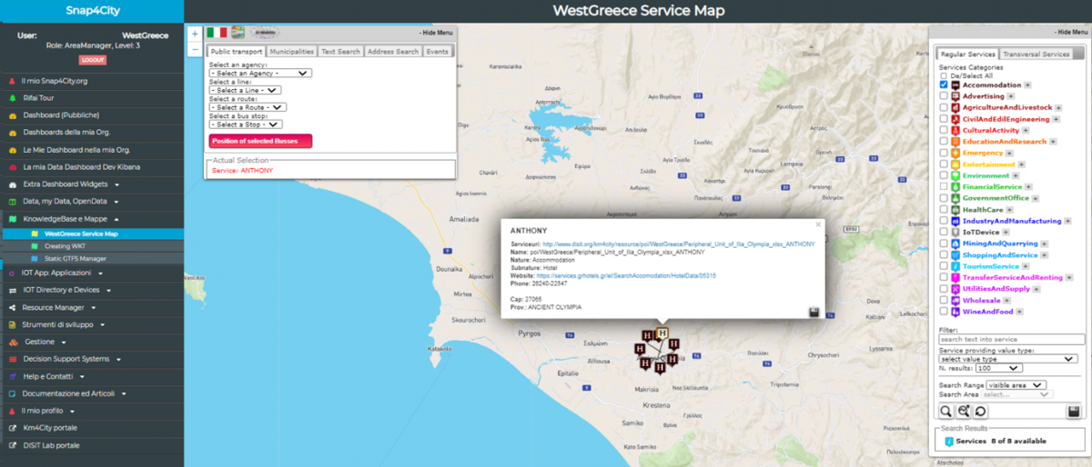
Example: The data owner can see the POI of the dataset Peripheral Unit of Ilia_Olympia.xlsx On ServiceMap.